

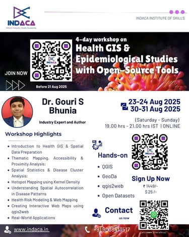
Health GIS & Epidemiological Studies
Unlock spatial solutions for public health research, disease tracking, and epidemiological modeling with our workshop.
Dates: Aug 23–24 & Aug 30–31, 2025 (Weekends)
Timings: 7:00 PM – 9:00 PM IST
Instructor: Dr. Gouri Sankar Bhunia, Remote Sensing and GIS Specialists | 16+ years of industrial and academic experience and Springer Author on Geospatial Analysis of Public Health (Springer 2018) and GeoComputation and Public Health: A Spatial Approach (Springer 2021)
Empowering Health Researcher
The growing demand for spatial solutions in healthcare research, disease tracking, and epidemiological modeling makes Health GIS a powerful tool for public health professionals, researchers, epidemiologists, and policy makers. This workshop introduces participants to the principles, tools, and applications of Health GIS using Open Source Software, focusing on real-world case studies and hands-on practice. Whether you're a public health researcher mapping disease spread or a student building your thesis with spatial health data, this training is designed to equip you with the necessary skills, workflows, and datasets to build powerful GIS-based health research projects.


What You’ll Learn:
Introduction to Health GIS & Spatial Data Preparation
Basics of Health GIS: Concepts, Importance, and Research Scope
Installing & Setting Up QGIS for Health Research
Sources of Open Health Datasets (WHO, DHS, OpenStreetMap, etc.)
Importing, Cleaning & Visualizing Spatial Data
Mapping Health Facilities, Cases, and Administrative Boundaries
Thematic Mapping, Accessibility & Proximity Analysis
Creating Thematic (Choropleth) Maps of Health Indicators
Buffer Zones for Health Access (e.g., Clinics within 5km)
Network vs Euclidean Distance in Health Accessibility
Overlaying Population Density with Disease Layers
Basic Raster Integration: Land Use, Air Pollution & Risk Zones
Spatial Statistics & Disease Cluster Analysis
Hotspot Mapping using Kernel Density Estimation (KDE)
Introduction to GeoDa for Spatial Epidemiology
Performing Moran’s I and LISA Cluster Analysis
Understanding Spatial Autocorrelation in Disease Patterns
Interpreting Health Clusters with Geo-visual Outputs
Health Risk Modeling & Web Mapping
Multi-Criteria Health Risk Zoning using Raster Overlay
Weighted Layer Analysis: Socioeconomic, Environmental & Health Indicators
Creating Interactive Web Maps using qgis2web
Final Project Demonstration + Q&A
Tools and Technologies
QGIS – Open-source GIS platform for mapping and analysis
GeoDa – Tool for spatial autocorrelation and cluster detection
qgis2web – Plugin for creating interactive web maps
Open Datasets – WHO, HealthMap, Census, OpenStreetMap
Data formats: Shapefiles, GeoTIFF, CSV, GeoJSON etc.
Health GIS & Spatial Data Preparation
Explore spatial solutions for healthcare research and disease tracking.
Thematic Mapping, Accessibility & Proximity Analysis
Hands-on workshop focusing on real-world applications of health GIS.

Spatial Statistics & Disease Cluster Analysis
Learn to model disease spread using GIS tools and datasets.
Learn to use Multi-Criteria Health Risk Zoning using Raster and Vector Overlay
Health Risk Modeling & Web Mapping
Major tools and plugins
QGIS – Core mapping & spatial analysis tool with plugins like MMQGIS, QuickMapServices, Heatmap, and qgis2web for data management, basemaps, hotspot mapping, and web map export.
GeoDa – Spatial statistics software for disease clustering (Moran’s I, LISA, Getis-Ord Gi*) and spatial regression analysis.

Contacts
contact@indaca.in
Socials
Subscribe to our newsletter
Copyright © 2025 Indaca Institute of Skills, All rights are reserved
WhatsApp: (+91) 9038413517
Call: (+91) 7439308037